
Mt. Whitney Training | Hike #5 | San Gorgonio
San Gorgonio: the last in our Mt. Whitney training hikes! And definitely the hardest. Here’s where you can read about the other training hikes we did leading up to this one:
This hike was by far the longest one in our training, ending up at around 19 miles. Because of how long it was, we decided it was best to drive up on Friday after work and camp the night before doing our long hike. We wanted to get an early start to try to beat the heat and because we knew it would be an all day hike. It was hard to find a place to stay the night before that was close to the trailhead, so we opted to backpack in and hike the mile uphill to Vivian camp - the first campground along the trail to San Gorgonio. This was my first true backpacking night and it was so fun! We had the place to ourselves and enjoyed an amazing sunset and some relaxation before our long hike.

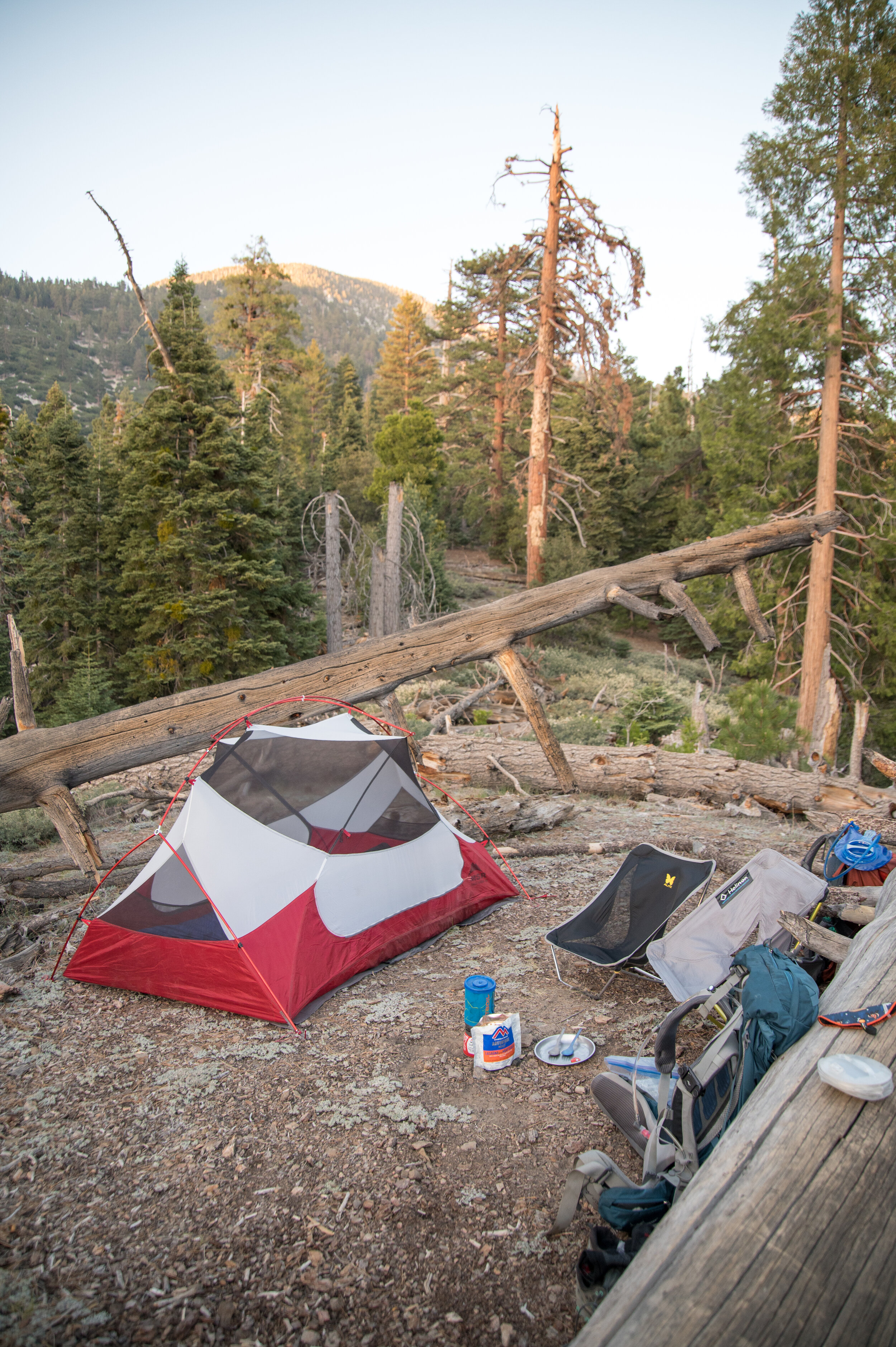


The next morning, we woke up early to pack up our campsite and head back down to the car. We decided to completely pack everything up and swap out our backpacking packs for our much lighter day packs. We were back on the trail a bit before 7 and ready for the long hike!


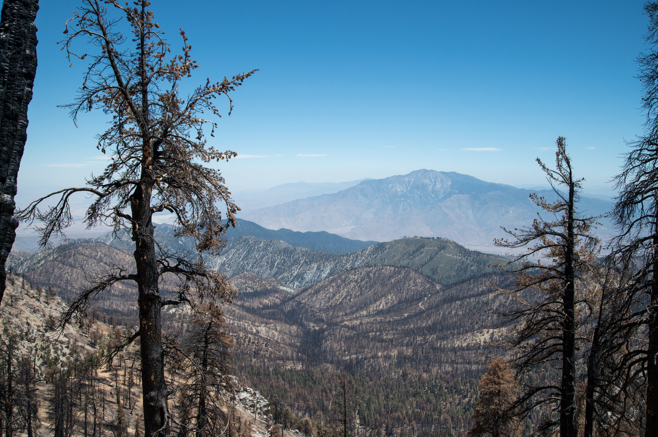
This was one of the longest hikes I’ve ever done, but there was so much variety that it wasn’t repetitive and was entertaining (and hard) so we definitely didn’t get bored. ;) The first part of the hike was more wooded and shaded, and it was so gorgeous watching the sun come up through the trees. Then we came up to a large section that was burned - I think there were some pretty bad wildfires here in 2020 which contributed to all of the burnt trees. It was pretty surreal to see.


And then we got to the hard part! We were up at a much higher elevation at this point (probably somewhere around 10,000 feet or more), it was in the middle of the day so definitely warming up, and it was hard! So much climbing, lots of loose dirt, and the sun was beating down on us. Even though we had not much more to go distance wise, it was definitely mentally tough and I struggled on the steep, exposed climb.
Once we finally got that part over, I was so relieved and knew that we would make it to the top no problem (I had some doubts as I struggled up the steep part). After the last push, there was just a short distance and a gradual uphill to hike over to the peak. Finally!


We ate lunch at the peak while soaking up the views and then headed back down the way we came. This hike is an out and back, and it felt like a loong way back. Though much easier and the same distance as going up, it was just mentally tough because after a while we were so ready to be done but still had so much longer to go!
Overall this hike was great, and I’ve heard that it’s a really good training hike for Mt. Whitney. I’ve heard that it’s one of the best ones you can do in Southern California that is comparative to the toughness of Whitney. It was a good one to check off our bucket list!
Hiking Stats (just an estimate since my Garmin died at the top):
Date: June 12, 2021
Distance: ~19 miles (Garmin said 9.40 miles at the top)
Time: ~10 hours (Garmin said 5 hrs 19 mins at the top)
Elevation Gain: 5,800 ft
Max Elevation: 11,474 ft
Map: