
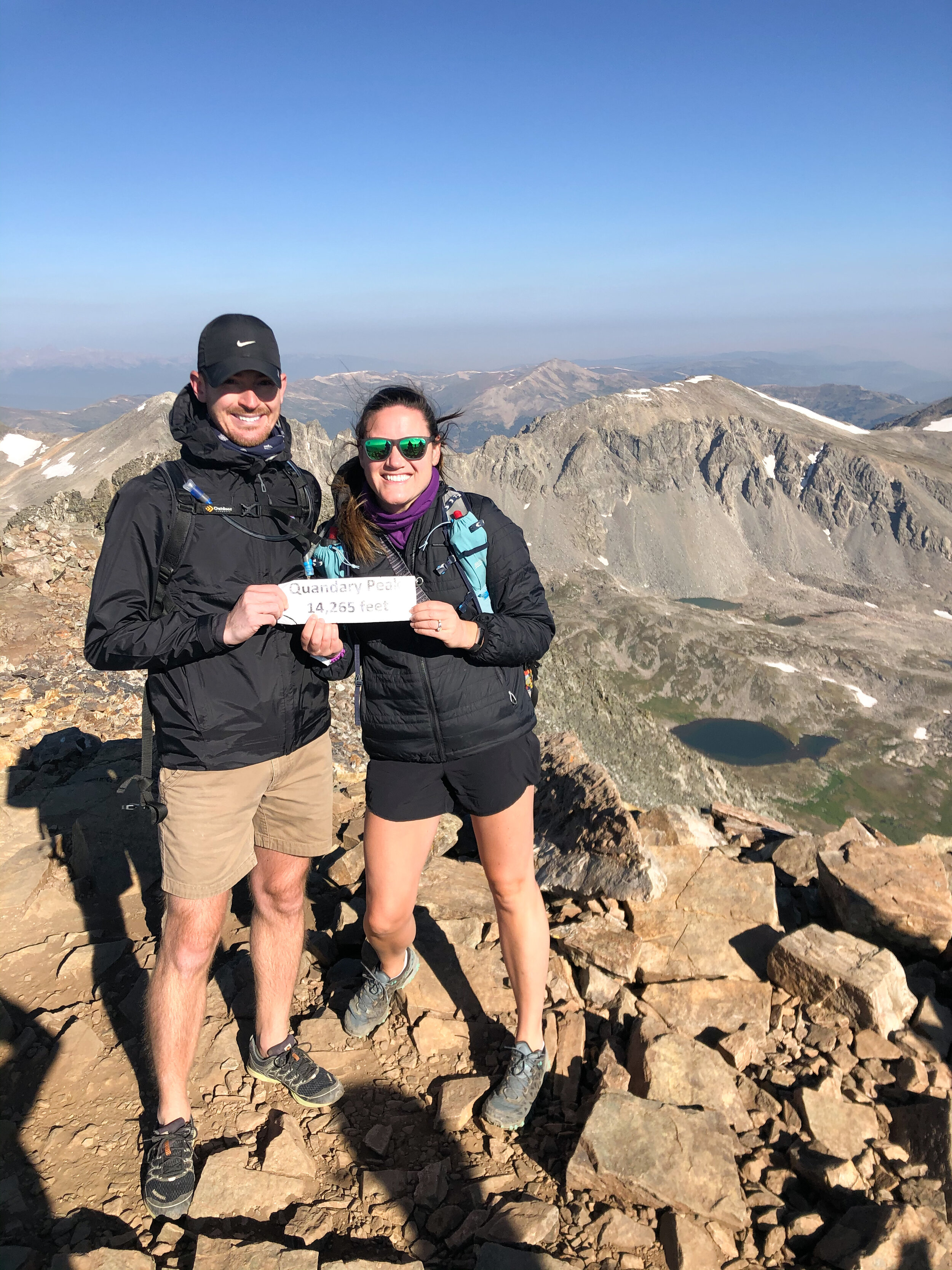
Quandary Peak 14er | Breckenridge, CO
In August this year during a trip to Breckenridge, my husband and I hiked our first 14er, Quandary Peak! This was a pretty last minute decision, but once we found out that there was a relatively easy 14er (as far as 14ers go) nearby, we could’t pass it up. Even with the last minute decision, I still felt completely prepared!
Some key things to keep in mind for your first 14er (and this one in particular)...
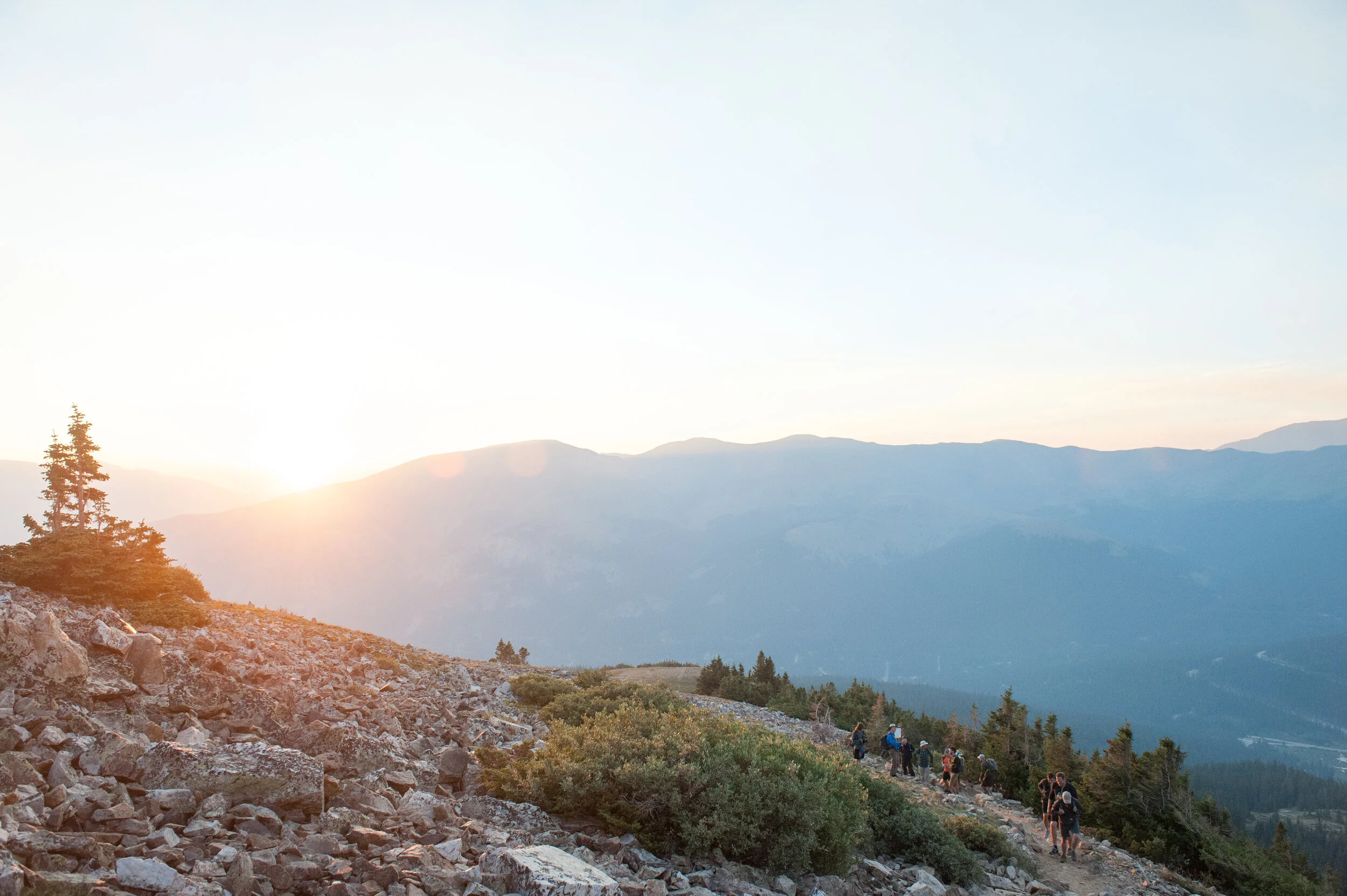
Start early (and on a weekday if you can). It’s never easy to wake up to an alarm at 4am, but we were glad we did for this hike! It can get very crowded in the summer, and parking fills up fast. Since we got there by 5am, we had no problems with parking. Theres two main parking areas, one right by the trailhead and one a bit further away that’s larger. We parked in the larger one and it was still pretty empty at that time in the morning. It may have been further to walk, but we just got an added warmup! With our luck, when we got to the trailhead we ran into a group of probably 20 guys who were starting the hike at the same time as us. It’s definitely not the hike to do if you want to be alone. Another reason to go early, especially in the Summer, is to avoid the afternoon storms. We didn’t have any storms while we were visiting Breckenridge (which we were actually disappointed about, we miss a good storm!), but still didn’t want to be stuck on the peak in case one did roll in.


Enjoy the sunrise. I think this one goes without much of an explanation. There are definitely perks to starting a hike before dawn!

Bring lots of water. I probably overpacked on the water, but I wanted to have more than not enough. I brought a 2 liter bladder + two running water bottles (couldn’t tell you the quantity of those) and that worked out almost perfectly. I was extra cautious to hydrate, so before we had even reached the peak I had already downed the 2 liters. One thing to keep in mind when you’re chugging all this water: there are not many private places to use the bathroom! But trust me, it can be done when it’s urgent.


Pack layers. I went back and forth so many times on this hike between being cold and hot! Since it was summer, I wore shorts and a tank top, but then brought a long sleeve and a down jacket, especially for the early start. I was grateful to have all 3 layers. Especially once we summited, we were automatically blasted with cold wind and I was very glad for my down jacket.

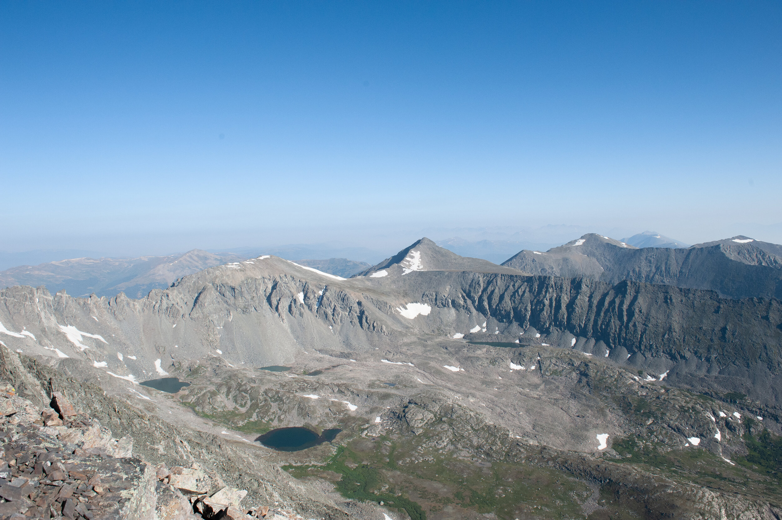
Go slow. This goes hand in hand with drinking water. If you want to be able to make it to the top and enjoy it, take your sweet time and get plenty of fuel! I am pretty sure I drove my husband crazy with the amount of stops I made, but I didn’t want to take any chances with the high elevation. Plus, I was happy to have the excuse to stop and take more pictures!

Wear sunscreen. The is a super exposed hike, with no trees for over half of the trail. Also if you start in the morning like us, on the way down you’ll be facing right into the sun.
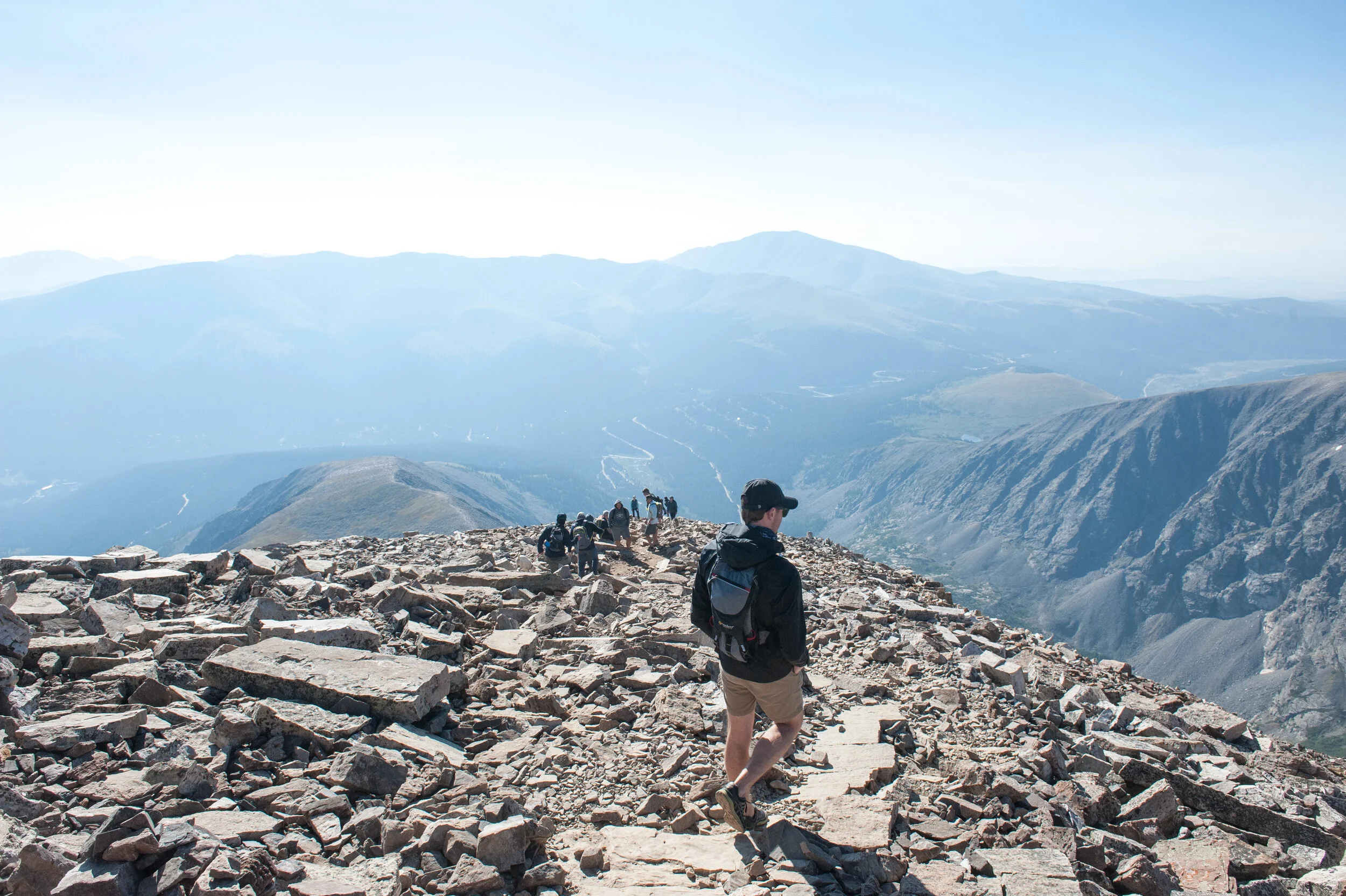

Enjoy the descent. One of my favorite feelings is making it to a peak after a tough climb. Second best to that, the descent! It felt great knowing that the hard part was done, and to be the ones climbing down instead of up! Don’t rush it though. It’s so beautiful to see the trail again in different light, and you don’t want to risk a twisted ankle after coming so far.


Ready to hike Quandary? Here’s some helpful information!
Distance: 7.5 miles (technically with our walk to/from the parking lot, it ended up being 7.82 miles)
Elevation gain: 3,339 ft.
Route type: out and back
Map (I found AllTrails to be pretty accurate):